Mon-Sat : 9:00-17:30
Closed on Sundays
+ 90 532 396 41 05
+ 90 252 712 41 01
+ 90 252 712 41 01
İskele Mah. Halil Aşkın Cad No:2/A Datça/MUĞLA

Mon-Sat : 9:00-17:30
Closed on Sundays
İskele Mah. Halil Aşkın Cad No:2/A Datça/MUĞLA
Select your language
")
")


Geo Transport is a geotechnical report software that prepares geotechnical reports in accordance with the provisions specified in the Turkish Building Earthquake Regulation (TBDY) and the format prepared by the Ministry of Environment and Urbanization.
User Reviews About Our Geo Transport Software
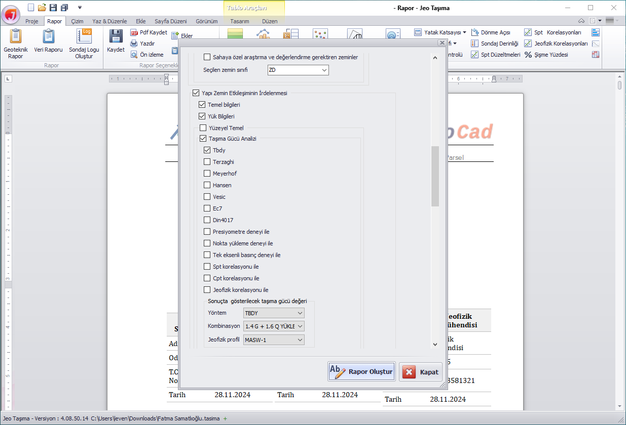
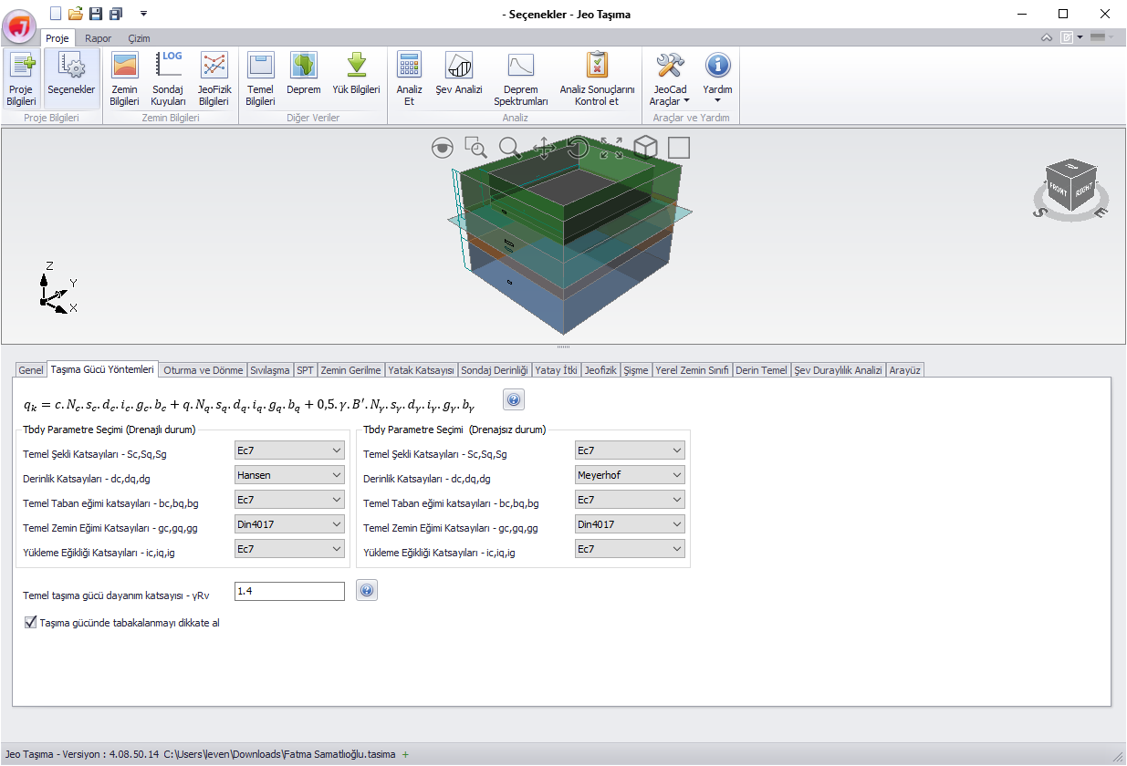
Analysis of bearing power can be performed using TBDY, EC7, DIN4017, Meyerhof, Hansen, Vesic, Terzaghi methods, as well as Presiometer, Point Load, Uniaxial Compression, Geophysics, SPT, and CPT techniques.
Instantaneous settlement, consolidation settlement (at the foundation corner and center point), as well as settlement and rotation analysis can be performed using the Schmertmann and Burland & Burbidge methods.
Liquefaction analysis can be conducted using the TBDY method to evaluate liquefaction potential, liquefaction risk index, post-liquefaction dynamic settlement, lateral displacement, and loss of shear strength.
Soil stress analysis can be performed using the classical 2:1 method, Boussinesq method, and Westergaard method.
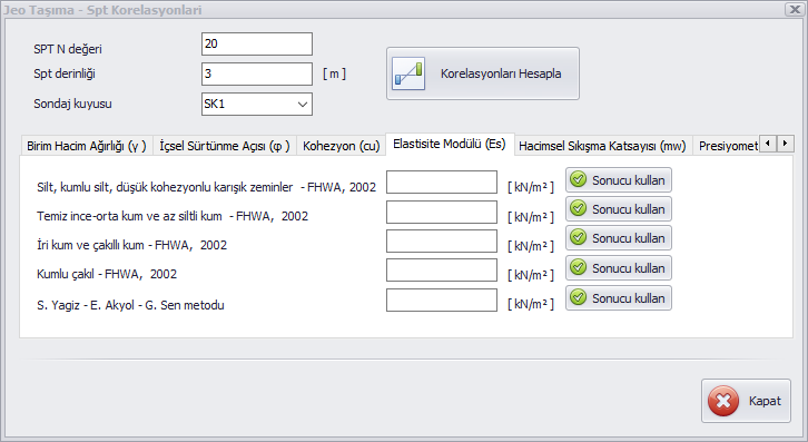
The subgrade modulus can be calculated using classical subgrade modulus methods, bearing capacity, and correlations based on SPT and geophysical data.
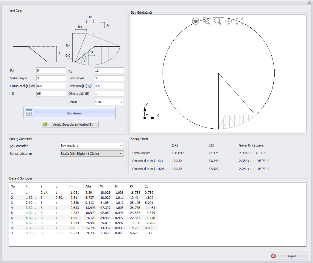
Slope stability of foundation pits can be performed according to the methods of TBDY 2018.
Horizontal sliding control of shallow foundations can be performed for both short-term and long-term conditions
Static, dynamic, and water-induced horizontal loads on basement walls can be calculated.
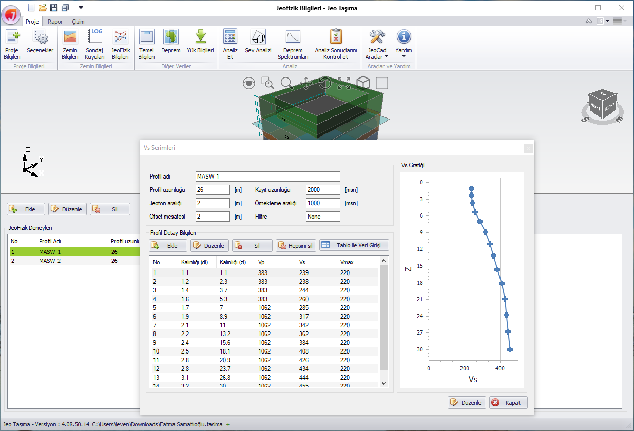
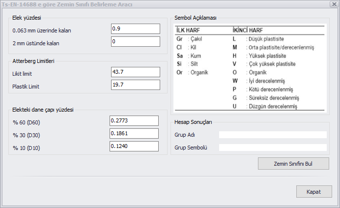
The local soil class can be determined based on Vs(30), N60(30), and Cu(30) values.
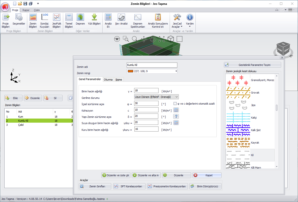
Unit weight, Elastic modulus, internal friction angle, cohesion, volumetric compression coefficient, and limit pressure correlations can be performed.
Soil dominant period, unit weight, internal friction angle, elastic modulus, soil bearing capacity, and many other correlations can be performed.
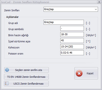
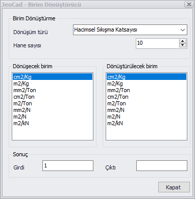
Swelling analysis, unit converter, calculation of soil physical properties, soil classes library, manual soil classification, ...
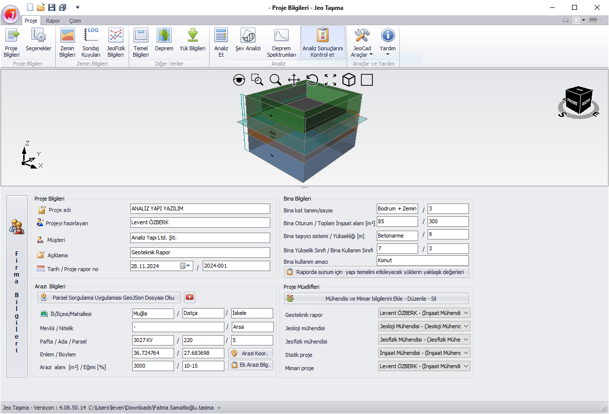
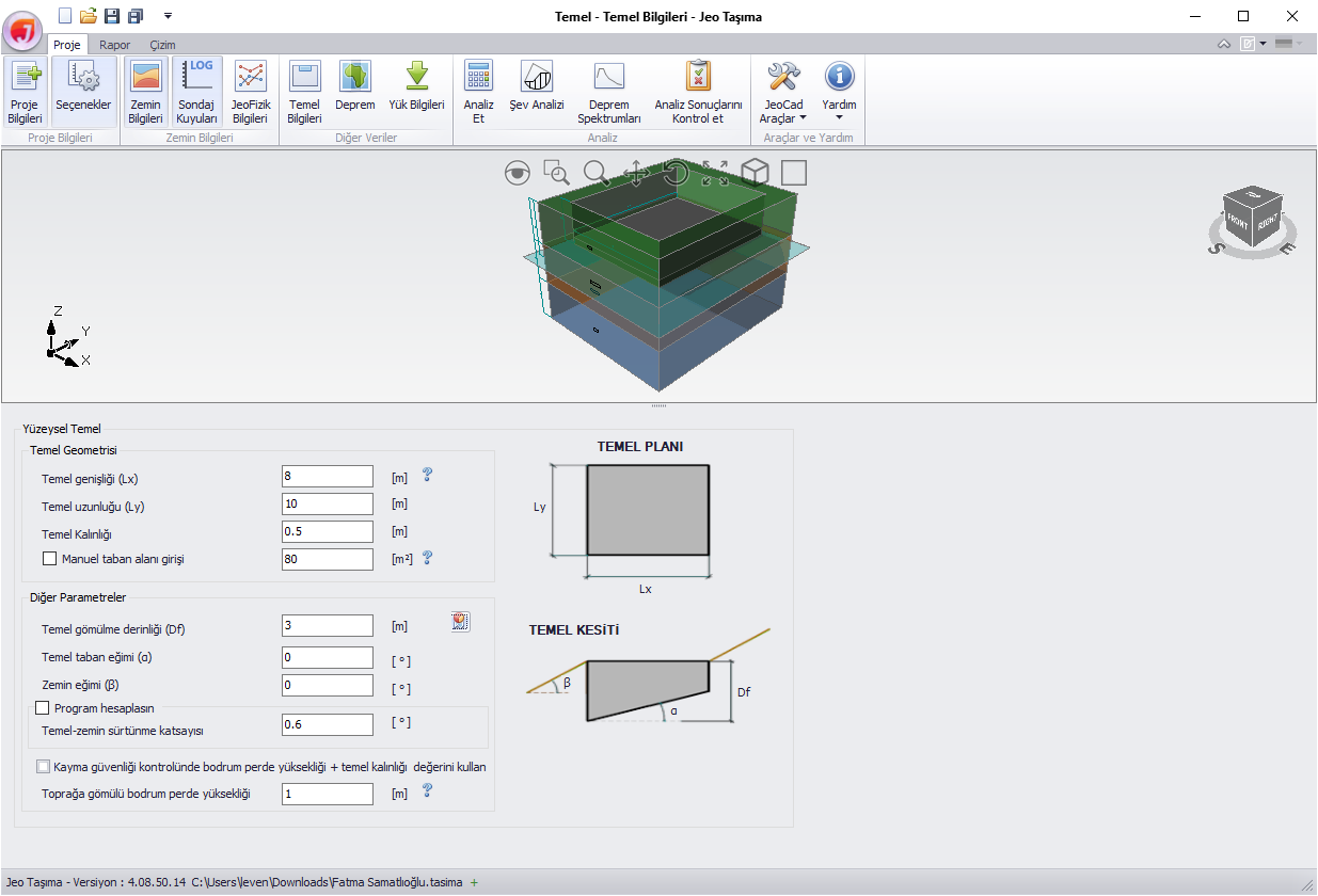
The modeled soil layers are displayed in 3D on the screen, either transparently or shaded according to the selected soil legend...
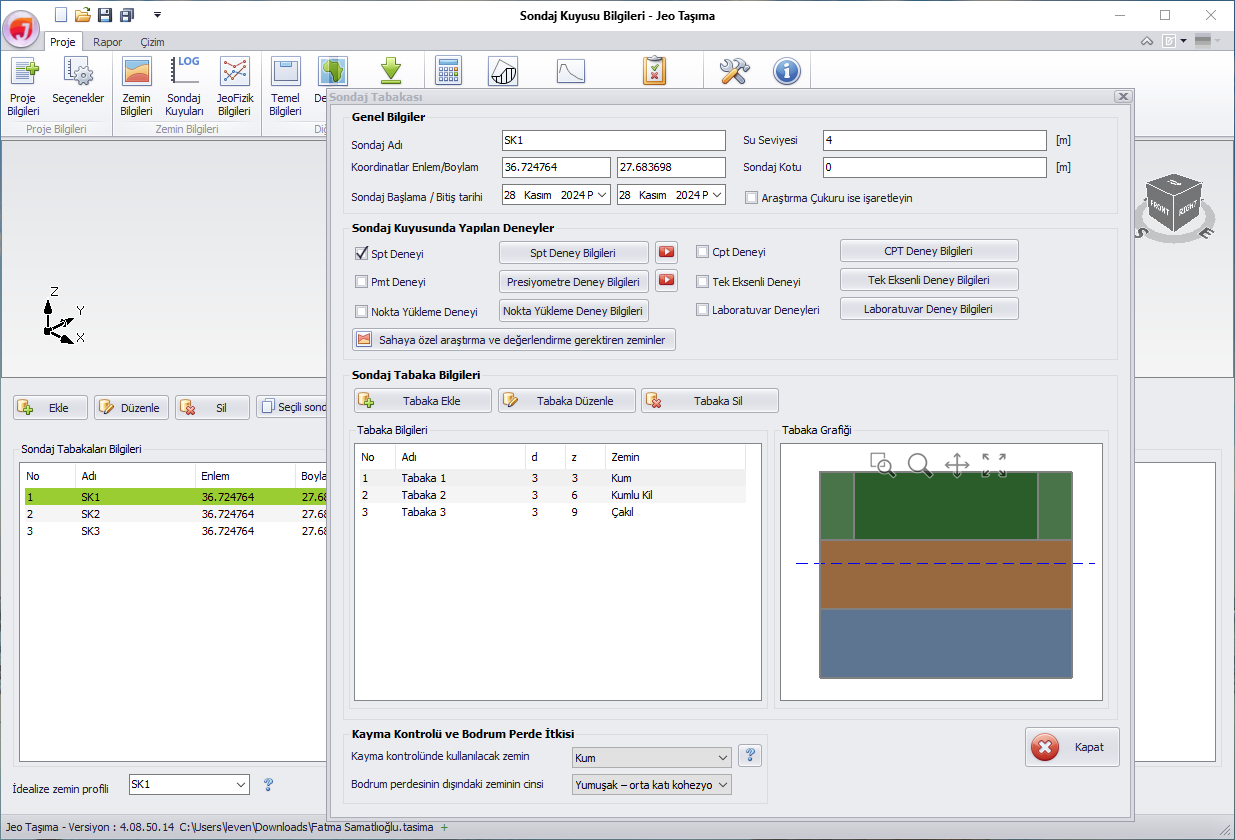
Stratified soil can be defined. The foundation location is automatically determined. Layering is considered based on the performed analyses.
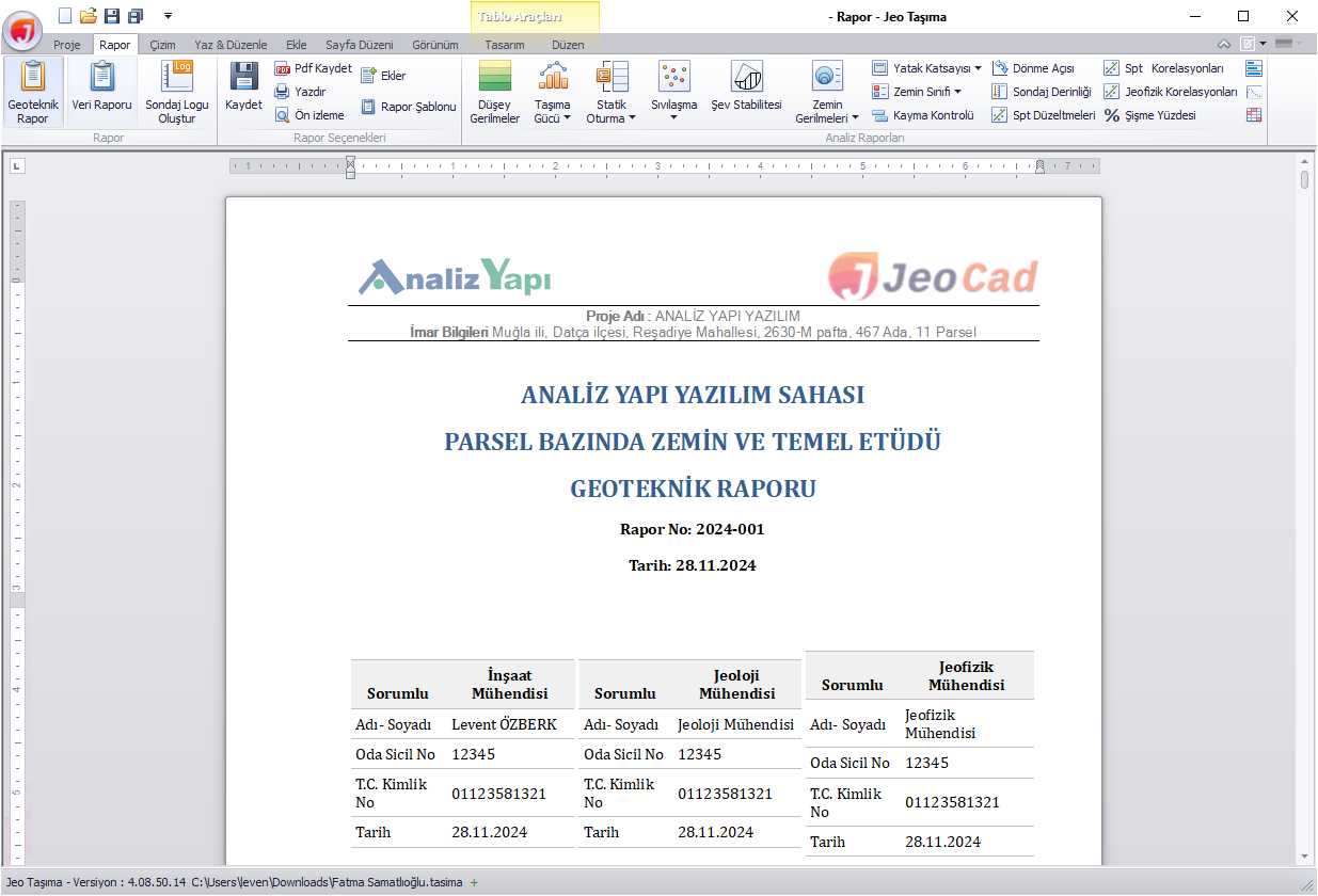
With the report editor, edits can be made to the report. Texts in the report can be changed, and tables or images can be added to the report.
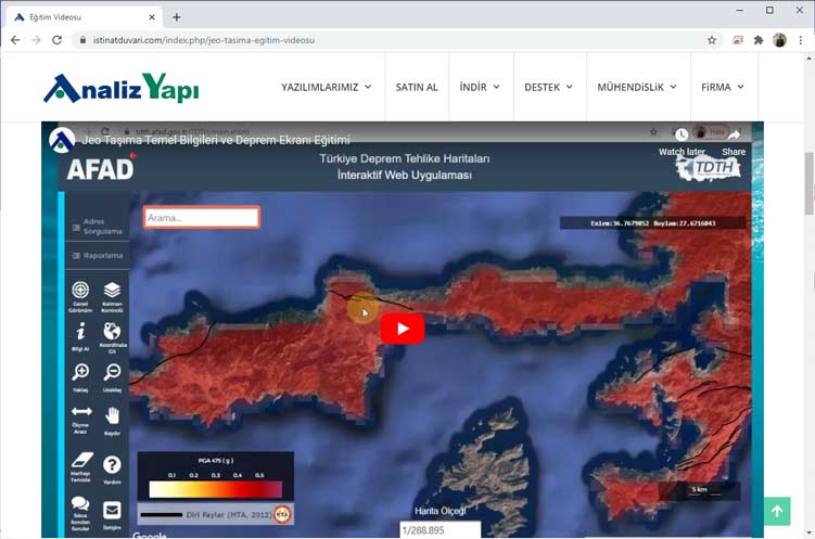
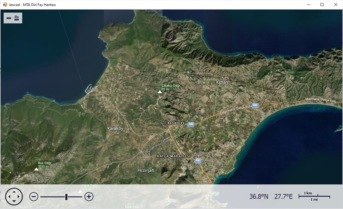
With the GeoJSON file obtained from the Parcel Inquiry Application, parcel information, parcel coordinates, and land boundary measurements are automatically read, and additionally, Earthquake Hazard Map parameters (Ss, S1, PGA, and PGV) are approximately obtained.
With the screenshot tool, images captured from the screen can be added to the desired section of the report. The added image is automatically included in the figure list.
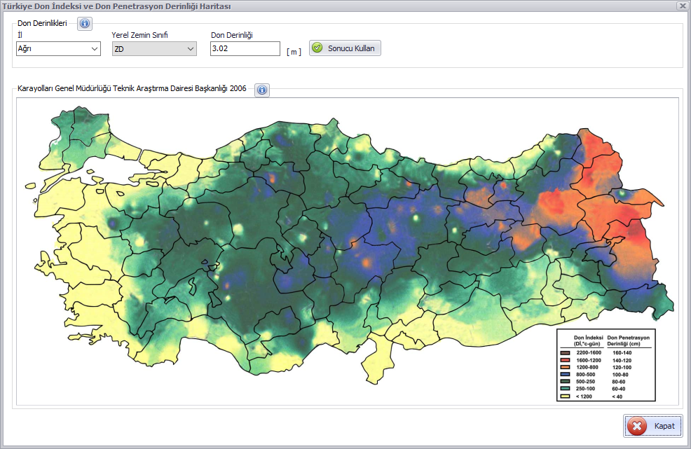
From the frost depth screen, frost depth values based on local soil classes for each province can be displayed. Additionally, the Frost Depth Map prepared by the General Directorate of Highways can also be viewed.
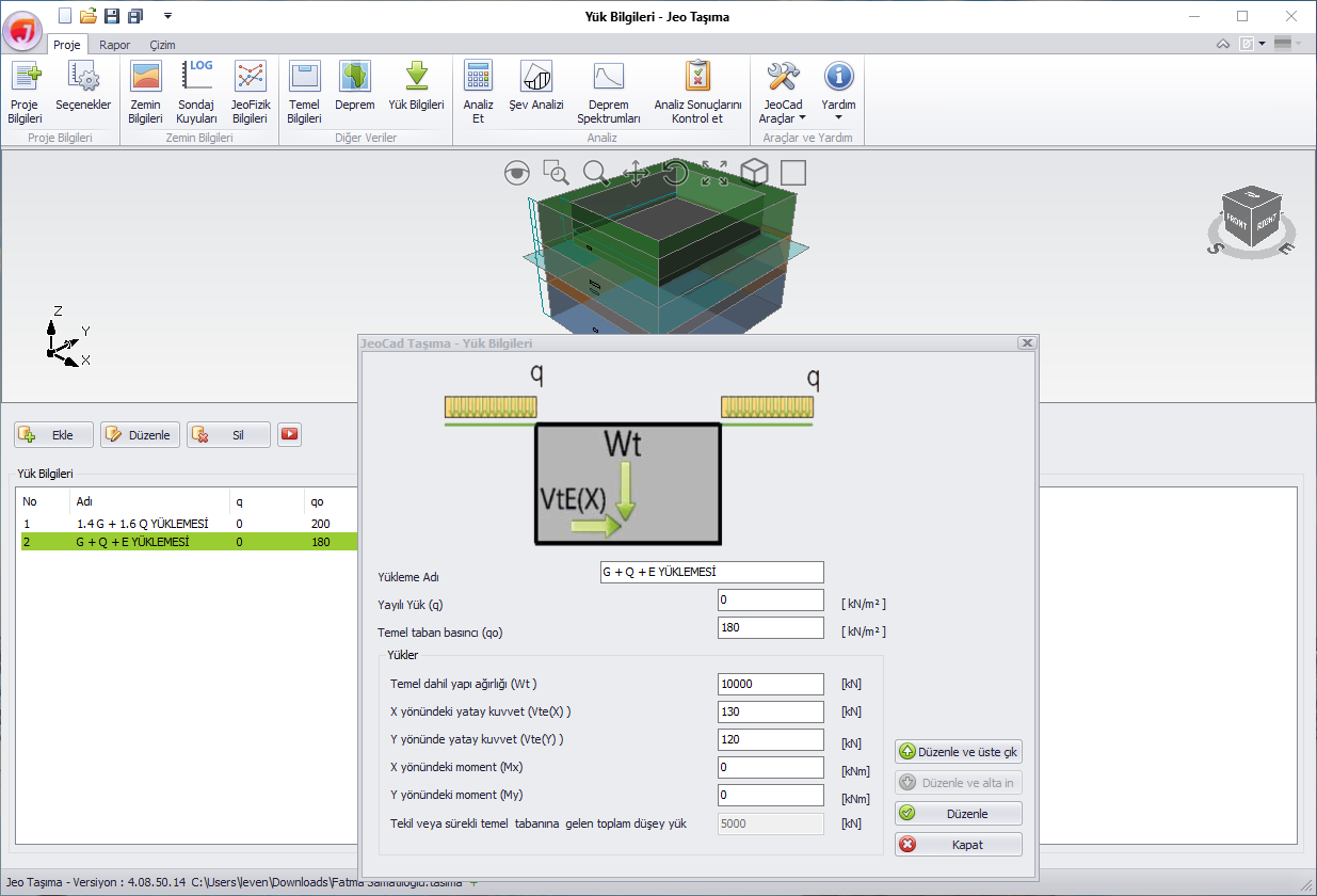
Multiple load combinations (q, qo, Wt, Vte(X), Vte(Y), Mx, My) originating from the structure can be applied to the model.
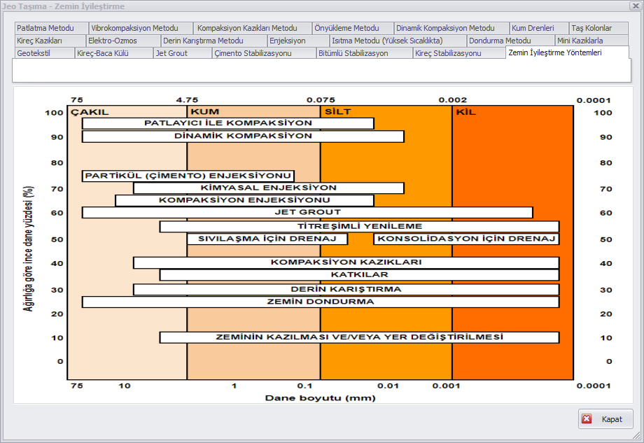
One or more of the 20 soil improvement methods available on the soil improvement screen, accessible from the report options, can be selected and added to the relevant section of the report.
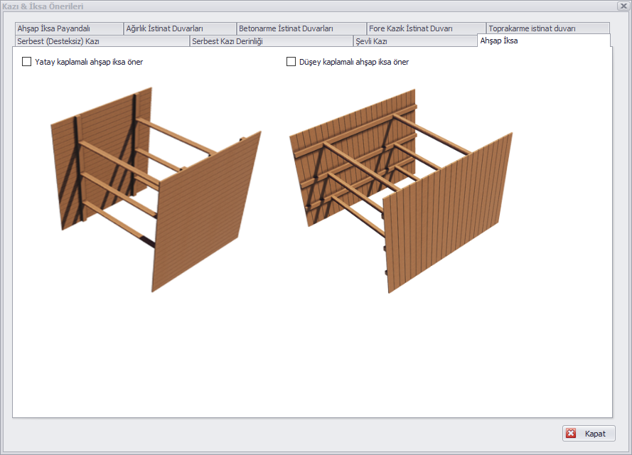
One or more of the 13 excavation, slope, shoring, and retaining wall methods available on the excavation and shoring screen, accessible from the report options, can be selected and added to the relevant section of the report.
Undrained cohesion and internal friction angle values can be determined based on the net ultimate bearing pressure.
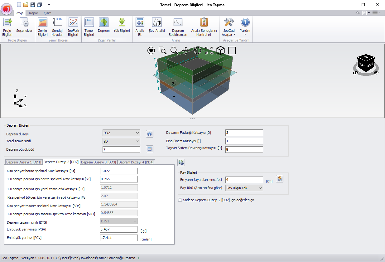
The Jeo Taşıma software can automatically generate and export horizontal and vertical earthquake spectra for all local soil classes, including ZF-class soils.
Drilling depth calculations can be performed based on foundation width, effective stress, soil stress distribution, and water table level.
Upgrade package from Jeo Taşıma versions 3 and below to version 4.8.
Compliant with TBDY 2018
Report in compliance with the Ministry format
Bearing capacity analysis
Slope stability
Package including Jeo Tasima 4.5 Software + Jeo Jet Grout 5.0 Software.
Upgrade package from Jeo Taşıma versions 3 and below to version 4.8.
Compliant with TBDY 2018
Report in compliance with the Ministry format
Bearing capacity analysis
Slope stability
Package including Jeo Tasima 4.5 Software + Jeo Jet Grout 5.0 Software.